Apple Maps gets more detailed 3D data for three more countries

France, Monaco, and New Zealand all now have updated terrain and road details as Apple Maps' new map data reaches sixteen unique locations.
New in Apple Maps are better highlighted areas, redesigned name labels, updated terrain information, improved visual clutter, as well as the addition of 3D models in locations for those three countries.
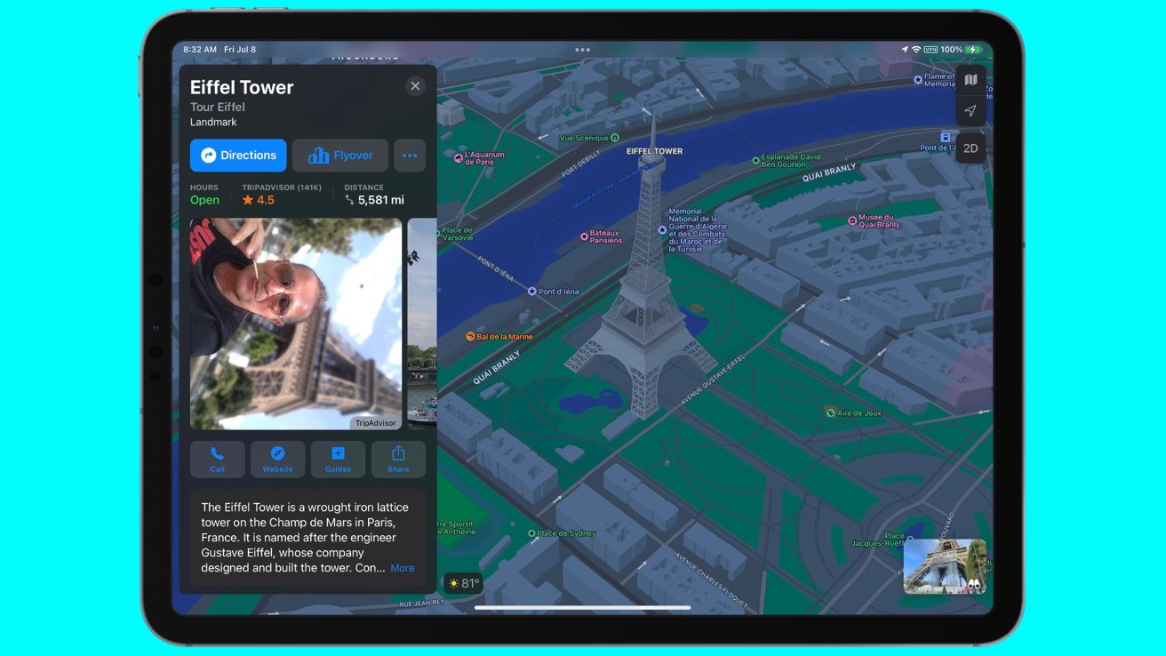
The most notable changes are in the metropolitan areas. In the case of Paris, France, businesses have been updated and re-organized in its presentation, and sites like the Eiffel Tower now has a 3D model in Flyover.
The new information covers a total population of 70.4 million among the three countries, and was a culmination of 39 days of public testing, according to mapping enthusiast Justin Oberine, who has been tracking the evolution of Apple's data collection for Apple Maps.
Oberine noted that the mapping data Apple has collected has now reached 19% coverage of the Earth's land area, and almost 10% of the world population.
Apple Maps has been continuously updated with new mapping information, as part of a global initiative that started in 2018. Earlier in April of 2022, Germany and Singapore received a similar facelift in its data with better detailing in labels, highlighting, and landmark modeling. June brought better information to 11 more countries, as well as the debut of multistop routing.
Read on AppleInsider
New in Apple Maps are better highlighted areas, redesigned name labels, updated terrain information, improved visual clutter, as well as the addition of 3D models in locations for those three countries.
The most notable changes are in the metropolitan areas. In the case of Paris, France, businesses have been updated and re-organized in its presentation, and sites like the Eiffel Tower now has a 3D model in Flyover.
The new information covers a total population of 70.4 million among the three countries, and was a culmination of 39 days of public testing, according to mapping enthusiast Justin Oberine, who has been tracking the evolution of Apple's data collection for Apple Maps.
Oberine noted that the mapping data Apple has collected has now reached 19% coverage of the Earth's land area, and almost 10% of the world population.
Apple Maps has been continuously updated with new mapping information, as part of a global initiative that started in 2018. Earlier in April of 2022, Germany and Singapore received a similar facelift in its data with better detailing in labels, highlighting, and landmark modeling. June brought better information to 11 more countries, as well as the debut of multistop routing.
Read on AppleInsider
Comments
Alas it will probably take years
There's a Wikipedia entry concerning Google Street View privacy concerns:
https://en.wikipedia.org/wiki/Google_Street_View_privacy_concerns
which illustrates a wide range of concerns that depend on local regulations. Note that these regulations evolve over time based on changes in the laws or the courts' interpretations of existing legislation.
For sure, satellite imagery has been altered or deleted in some cases. There have been successful lawsuits concerning street view recording.
Do not assume that the Wikipedia article is comprehensive and up to date.
Remember that in 2022 at least here in the USA, there's very little personal privacy left. Things like your name, age, previous residences, employment, tax history, political donation history, etc. are all recorded in various public databases.
Apple has been moving slowly but steadily in the right direction after its debacle of a launch and their best maps are now far superior to Google in my opinion.
As I geographer myself I think it’s time to retire aerial photography in these areas that have the ultra-detailed map. There is no benefit to it and it actually has numerous flaws and weaknesses compared to the ultra-detailed, 3D vector map. It’s also typically far less current than the continually updating vector map.
I would also like a better way of showing bus routes because currently it doesn’t aid discoverability at all. Perhaps, for example, by selecting a bus stop it could show all routes using that shop in a colour-coded fashion. Sydney has hundreds of bus routes and even locals struggle with it.