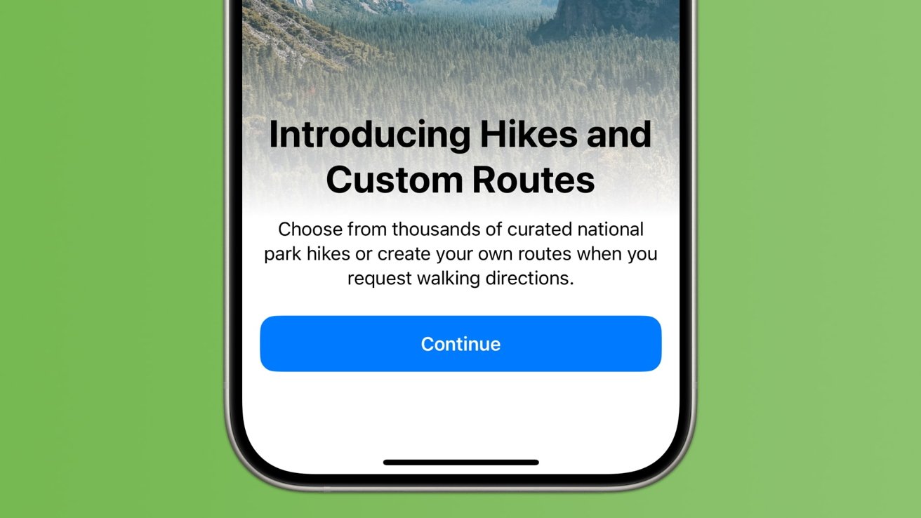
How to plan hikes & other outdoor adventures in Apple Maps with iOS 18

Apple Maps in iOS 18 has been significantly upgraded, offering hikers and outdoor enthusiasts new ways to plan adventures. Here's how to prepare for a hike in Apple Maps.
Apple Maps offers hiking routes in iOS 18
The updates to iOS 18's Maps app make it an invaluable tool for planning hikes and outdoor activities. With detailed mapping, real-time data, and a wealth of user-generated content, Maps provides a comprehensive solution for outdoor enthusiasts.
Whether you're a seasoned hiker or a beginner, iOS 18 Maps ensures that your next adventure is well-planned and enjoyable. And since Apple added the ability to download maps offline with iOS 17, hikers can feel safe without an internet connection.
How to plan a hike for popular trailheads
You can create custom topographic hiking trail maps on your iPhone, iPad, or Mac and access them on both your iPhone and Apple Watch.
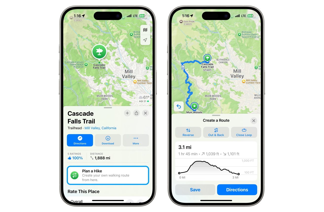
Popular trailheads are accessible in Apple Maps
- Open Apple Maps on iPhone, iPad, or Mac.
- Search for a trail or national park. Select the Trailheads/Trail button and choose a trail.
- Tap the Plan a Hike button, then tap on the map to set your route.
- View distance and elevation, then choose options like Reverse, Out & Back, or Close Loop.
- Save and name the route, then tap Done.
However, you might find that certain parks or hiking trails don't have the "Trailheads" button, or you want to create a walking route through a city. In that case, you can start a custom route.
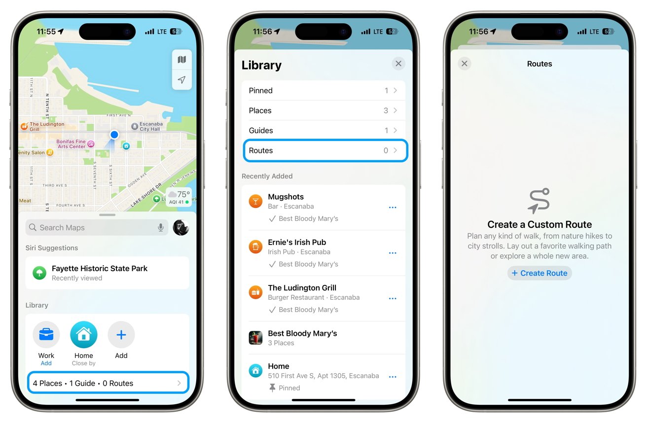
How to plan a custom route in Apple Maps
- In the default view in Apple Maps, find the Library section and tap underneath to choose Places, Guides, and Routes.
- After selecting Routes, Create Route, you can tap the map to add a starting point, then tap other locations to visit.
- You'll see the same options for Reverse, Out & Back, or Close Loop.
- Finally, tap Save or Go and start the route when ready.
How to plan a custom route in Apple Maps
Apple Maps in iOS 18 enhances the hiking and outdoor planning experience with detailed topographical maps, real-time data, and user-generated content. These features ensure that both seasoned hikers and beginners can plan their adventures effectively and safely, even offline. Whether following popular trails or creating custom routes, iOS 18 Maps offers tools for a fun outing.
Read on AppleInsider
Comments
It WilliamM said: I use AllTrails. It works internationally.
Am I missing something or is this really only good for day trips?
I just did a manual map of the Huatoki Walkway and it was awesome how it follows the walkways on the map. I expected to have to do a heap of points to get the contours right but I didn't. This is going to be an awesome update even for manual updates.